IFC georeference: official geodata with AI
Once your IFC model knows its place, your AI fetches official geodata for it through moddl: parcels, neighbouring buildings and the terrain from the national survey's terrain model. You dimension the boundary distance and calculate the spoil of an excavation. Every number shows where it comes from.
01What you can ask once the model knows its place
Say what you want to know or see about the plot, and your AI fetches the data through moddl. For example:
Create the terrain from the DTM, 50 m around the building.
Fetch the parcels, record our parcel on the site and dimension the shortest boundary distance.
Show me the neighbouring buildings within 50 m.
Dig a pit down to the underside of the slab, with 1 m working space and a 1:1 slope. How much spoil is that?
02Setting the georeference: IfcMapConversion and height
The georeference says where the origin of your model lies in the national grid. In IFC it is an IfcMapConversion with coordinate system, easting, northing, rotation and height. If your file has one, moddl reads it. Otherwise your AI creates it with set_project_origin. For that it needs the EPSG code, easting, northing and height as they stand in the site plan or the survey.
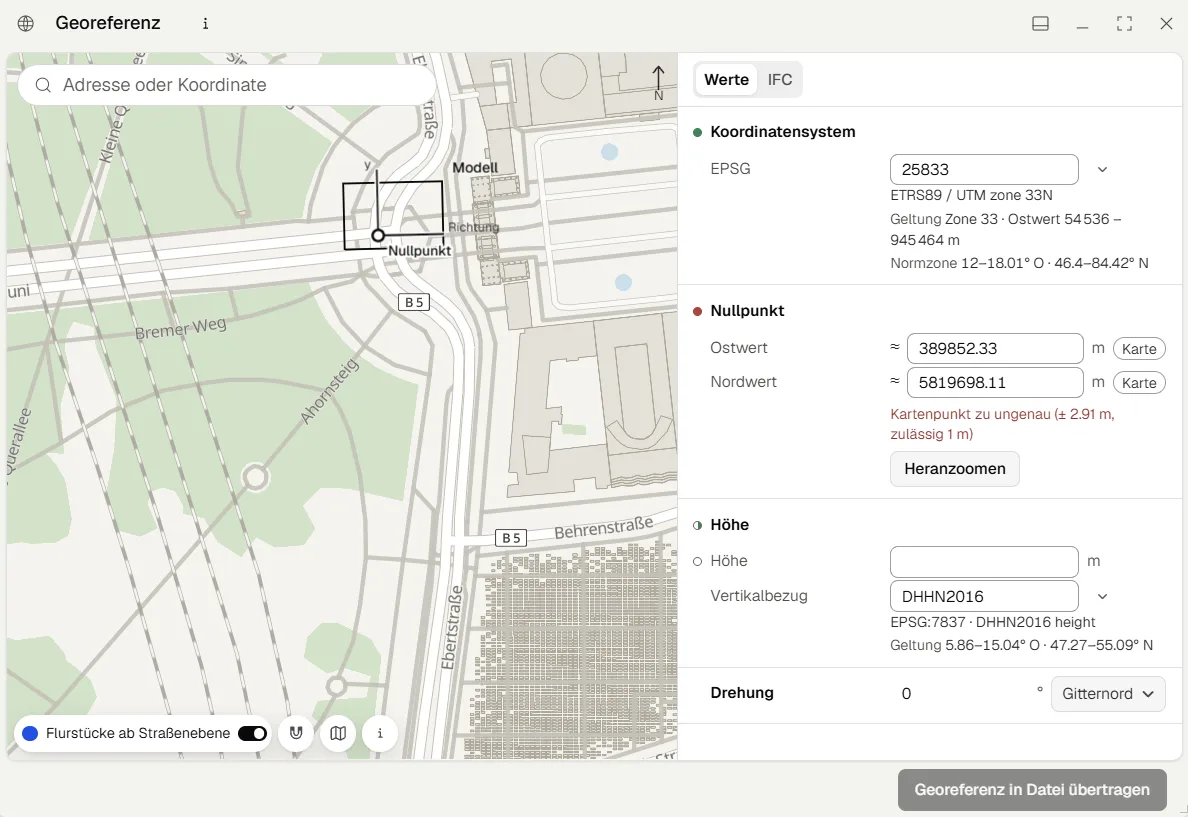
Map: OpenFreeMap © OpenMapTiles, data © OpenStreetMap contributors
moddl checks easting and northing against the coordinate system, such as the UTM zone, and refuses values that lie outside it. Where official terrain exists at the site, moddl compares the height with it too. A value in centimetres or an ellipsoidal height stands out there and is refused.
How far your AI gets from there depends on what the georeference contains. The position alone is enough for parcels and neighbouring buildings. A site plan in national grid coordinates (DXF, GeoJSON) also lands in place in the model with it. Terrain and excavation need the height of ±0.00 above the vertical datum as well (OrthogonalHeight), for example from the building permit. Without it, moddl refuses the terrain import, because the ground would otherwise sit metres above or below the building.
03Cadastral parcels and boundary distance
With get_geodata your AI asks the state's service for the parcels around your model, by default within 50 m of the building. The parcel the model stands on comes first, the others follow by distance. The answer is kept as a reference in the project and shown in the viewer. Your IFC file stays unchanged.
With import_geodata your AI writes your parcel to the site in the model (IfcSite): the official identifier as Pset_LandRegistration.LandID, plus service, fetch time, licence and the area from the outline, which is marked as an assumption.
Your AI dimensions the shortest distance to the boundary in the model. On the example house moddl measures 7.82 m to the parcel boundary, without the roof overhang.
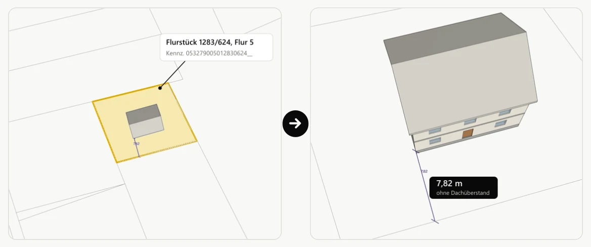
Parcels: ALKIS © Geobasis NRW, dl-de/zero-2.0
Your AI fetches the outlines of the neighbouring buildings the same way. They lie in place around your model as a reference. moddl does not write them into the IFC file.
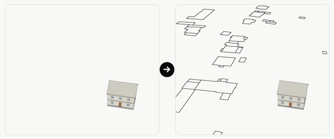
Buildings: ALKIS © Geobasis NRW, dl-de/zero-2.0
04Terrain from the DTM as an IFC terrain model
With get_geodata your AI fetches the official digital terrain model (DTM) around your building, and with import_geodata places it under the building as terrain (IfcGeographicElement). The terrain carries the surveyed heights: you see where it falls and how the building sits in the slope.
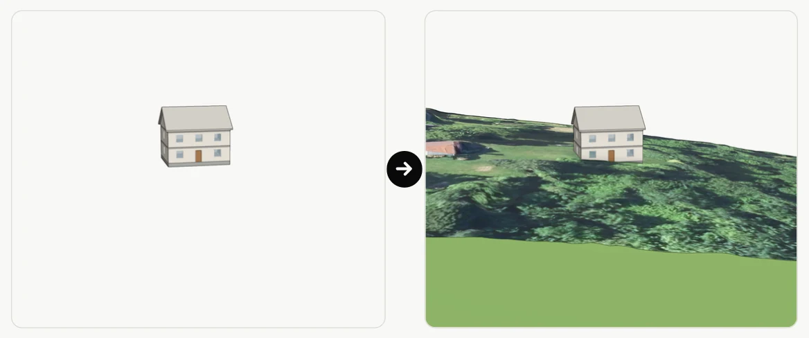
Terrain: DGM1 © Geobasis NRW, dl-de/zero-2.0 · Aerial image: © Geobasis NRW, dl-de/zero-2.0
moddl thins the raster, at most to the deviation you or your AI name. Cells without a height stay open, moddl does not fill them in. You or your AI also name the bottom of the terrain body. moddl never assumes it. Origin, licence and credit are stored with the terrain in the file.
Afterwards moddl compares the terrain height under the building with the ground floor and warns from a difference of 3 m. A difference like that comes from an error in the vertical datum or from a slope.
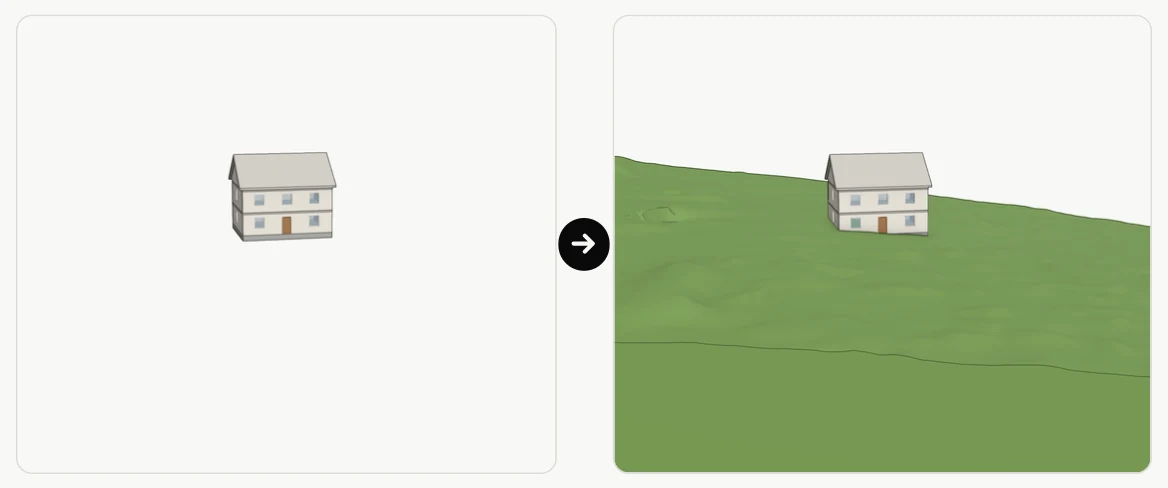
Terrain: DGM1 © Geobasis NRW, dl-de/zero-2.0
05Excavation: calculating the spoil
With edit_terrain your AI cuts a pit into the terrain: around the elements you name, with working space, with the floor below their lowest point and with a slope of 1:n. moddl measures the excavated volume on the terrain mesh.
For the example house moddl measures approx. 183 m³. The number is marked as an assumption, because the terrain comes from the state service and not from a survey of your own. For each edge of the pit floor the report also gives the width of the slope.
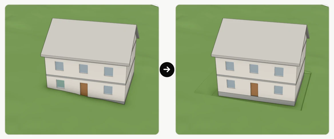
Terrain: DGM1 © Geobasis NRW, dl-de/zero-2.0
06Where the geodata comes from
moddl asks the official services of states and countries. Which service covers your site is stated in the answer to the first request. In Germany there are parcels for 12 states today, building outlines for Berlin, Brandenburg, Hesse, Lower Saxony and North Rhine-Westphalia, and terrain for Brandenburg, Hesse, Lower Saxony and North Rhine-Westphalia.
Outside Germany there is terrain for Switzerland, Czechia, Poland, South Tyrol, the Netherlands, England and the USA, and parcels for France, Spain, Italy, the Netherlands, Poland, Czechia, Flanders, Brussels and Connecticut, among others.
Every answer names service, fetch time, licence and credit. The credit stays with everything built from the data, including the terrain in your IFC file. That is why it also appears under the pictures on this page.
07Getting started with the georeference
Frequently asked questions
What are the requirements?
You need an AI assistant with MCP support, for example Claude or ChatGPT. ChatGPT can also be used on the free plan. You connect it with your own account, without an API key: Edit BIM with your own AI subscription.
How do I connect Claude or ChatGPT?
moddl walks you through the connection step by step in the viewer. You can also read the guides here: Connect Claude to moddl and Connect ChatGPT to moddl.
What does it cost?
During the beta phase, expected to run until June 30, 2027, moddl is free of charge. We will usually announce the end of the beta at least two weeks in advance. Your AI assistant is subject to your provider's terms.
Does the AI get access to my IFC file?
No. The AI receives only the answers to its requests and reports on the changes it has made. These answers may contain content from the model, such as element names and properties.
Can changes be undone?
Yes. Every change creates a new version, and every earlier version can be restored. The uploaded original file stays unchanged.
Can I use the result in my BIM software?
Yes. You can export the model as an IFC file at any time. moddl writes only the parts that changed; all other values are preserved unchanged.