References in the IFC model: read plans and rebuild with AI
Load survey plans, floor plans and site plans beside your IFC model. Your AI reads them through moddl, aligns them to the model and builds walls and columns on them. Your IFC file only changes when the AI builds. When the AI aligns a plan on its own, its placement stays marked as an assumption until you confirm it.
01What you can ask once a plan is in the project
Say what you want to do with the plan, and your AI reads it through moddl. For example:
Align the ground floor plan to the model: two corners of the outer wall as pairs, a third one as the check.
Rebuild the walls from the survey plan: outer walls 36.5 cm, inner walls 24 cm, height 2.60 m.
Place a 30/30 column at the picked point, as high as the storey.
Place our site plan through the georeference and add the parcels.
02Which plans moddl takes as references
You add references in the viewer, in the References window. This needs a moddl account. moddl takes drawings as DXF and DWG, sheets as PDF, PNG and JPEG, as well as GeoJSON and LandXML. A reference belongs to the project: every model in it sees it, and no IFC file changes when you add or align a reference.
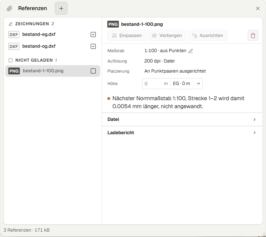
Sample project with sample sheets drawn by us
With read_reference your AI reads a reference: the lines per layer in the units of the file, plus the frame that says where the drawing lies in the model. For large drawings it asks for single layers or an extract. What a line means is for you or your AI to say. moddl never turns a line into a wall.
A sheet (PDF, PNG, JPEG) needs a scale to turn points into metres. Name it, or your AI measures it from two points while aligning. A measured scale stays marked as an assumption. From a PDF your AI reads the lines, from an image only its size. For a scanned sheet you therefore name the dimensions yourself.
03Rebuild the existing building from the plan
Once the survey plan lies at the model, your AI rebuilds the walls along its lines. You name thicknesses and height, since moddl reads lines from the plan, not elements.
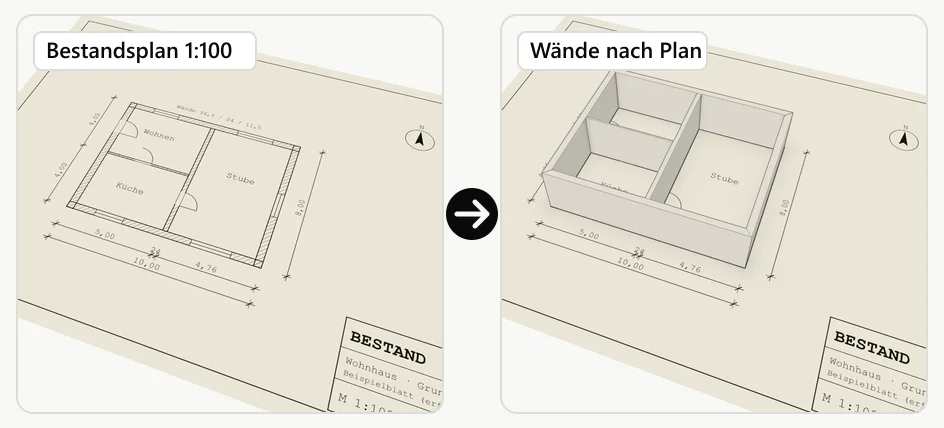
Survey plan: sample sheet, drawn by us
With several storeys it goes storey by storey: with place_reference your AI puts each floor plan at the height of its storey and builds the walls on that plan.
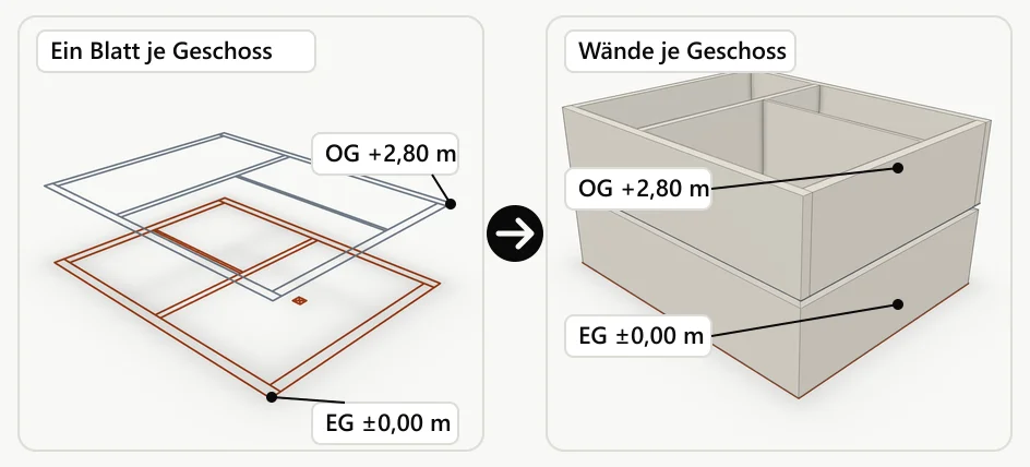
Ground and first floor plans: sample sheets, drawn by us (DXF)
04Align plans by point pairs
When a plan comes in its own coordinates, shifted or turned, your AI aligns it with place_reference: two point pairs from plan and model give position and rotation, a third point checks the result. The report gives the rotation, the length deviation and the residual at the check point. Where the residual exceeds the tolerance, the report says so at the top. Your AI sets unit and height the same way.
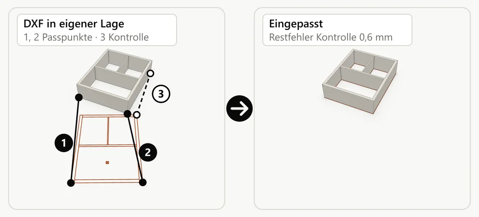
Ground floor plan: sample sheet, drawn by us (DXF in mm)
A plan your AI aligns on its own counts as assumed until you confirm the placement. The placement is not part of your model's revisions, since it changes only the reference. The last change can be undone once.
05Point at the plan, measure on the plan
Pick a point in the plan in the viewer, such as where two lines cross. With get_selection your AI reads it from your selection and places the element you name there. It reads objects you pick in the drawing the same way.
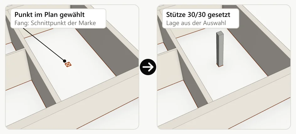
Ground floor plan: sample sheet, drawn by us (DXF)
The viewer's measure tool also snaps to references, to corners and intersections of the lines. So you can measure on the plan yourself.
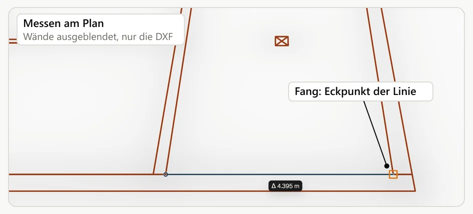
Ground floor plan: sample sheet, drawn by us (DXF)
06Site plan from DXF and GeoJSON
A site plan in national grid coordinates lies at its place through the georeference of your model. moddl converts a GeoJSON in WGS84 into metres in your model's coordinate system and gives the deviation of that conversion. Without a georeference moddl refuses the site plan rather than put it anywhere.
A DXF in national grid coordinates is placed by your AI with place_reference in mode georef: the drawing coordinates then count as coordinates of the georeference. If the DXF lies at the project origin instead, your AI chooses mode origin.
Your AI adds official parcels and neighbouring buildings as references too. How that works and what the georeference needs for it is on the page Georeference, terrain and parcels.
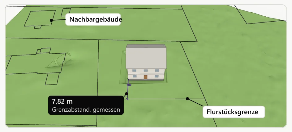
Parcels and buildings: ALKIS · Terrain: DGM1 · © Geobasis NRW, dl-de/zero-2.0
07Coordinate with other disciplines
You show a model of another discipline from the same project inside your own as a reference model, such as the structure inside the architecture. In the viewer you see both together, and neither changes the other.
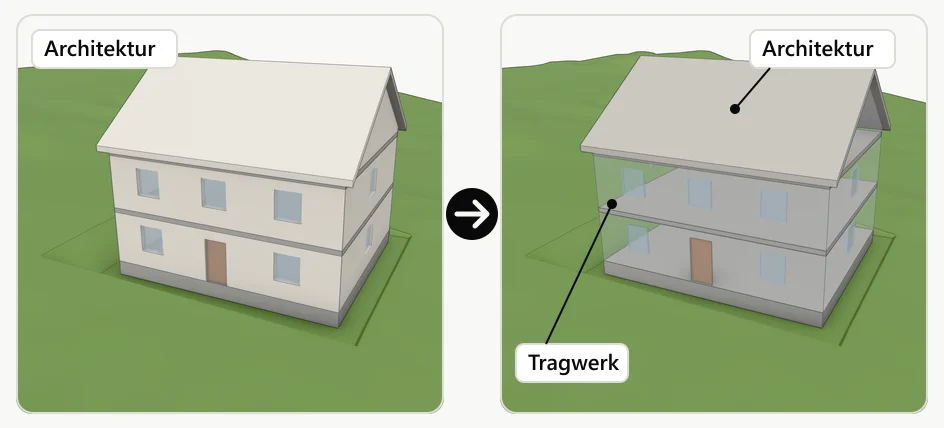
Terrain: DGM1 © Geobasis NRW, dl-de/zero-2.0
On request your AI reads the other model too: with open_model it switches there, reads what you want to compare, and returns to your model. The connection needs access to your moddl account for this.
08Compare with the survey
Your AI can query a survey as a point cloud with read_reference: in an extract moddl gives the number of points, their heights and the dominant plane. For each element it also gives how far away the nearest points lie. moddl never hands out the points themselves. Uploading point clouds is not yet enabled on moddl.site.
09Getting started with references
Frequently asked questions
What are the requirements?
You need an AI assistant with MCP support, for example Claude or ChatGPT. ChatGPT can also be used on the free plan. You connect it with your own account, without an API key: Edit BIM with your own AI subscription.
How do I connect Claude or ChatGPT?
moddl walks you through the connection step by step in the viewer. You can also read the guides here: Connect Claude to moddl and Connect ChatGPT to moddl.
What does it cost?
During the beta phase, expected to run until June 30, 2027, moddl is free of charge. We will usually announce the end of the beta at least two weeks in advance. Your AI assistant is subject to your provider's terms.
Does the AI get access to my IFC file?
No. The AI receives only the answers to its requests and reports on the changes it has made. These answers may contain content from the model, such as element names and properties.
Can changes be undone?
Yes. Every change creates a new version, and every earlier version can be restored. The uploaded original file stays unchanged.
Can I use the result in my BIM software?
Yes. You can export the model as an IFC file at any time. moddl writes only the parts that changed; all other values are preserved unchanged.